
Billingers are likely descended from the people of Billa, a people who settled around Europe and who came over to England a century or so after the Romans departed. Norfolk and Lincolnshire have many Billinga place names, just as our area has many Anglo-Saxon names. One tribe made their main settlement Billinge.
It was relatively peaceful while the area was sparsely populated, but with population growth and harsh times caused by famine and epidemics, there was a lot of tribal squabbling between Angles, Saxons, Vikings, and native Celts in these centuries.
Those who liked the high ground found Billinge good, at around 630 feet, looking out over the whole of the Mersey valley. They kept themselves to themselves and kept the land to themselves. Before the Norman Conquest Billinge was one of the fifteen berewicks, or dependent manors, of Newton.
The first recorded death of a Billinger is in A.D. 967. They could see their Parish Church in Wigan, five miles away, for services, baptisms, and burials. Around 1535 a chapel was built to ease the walking.
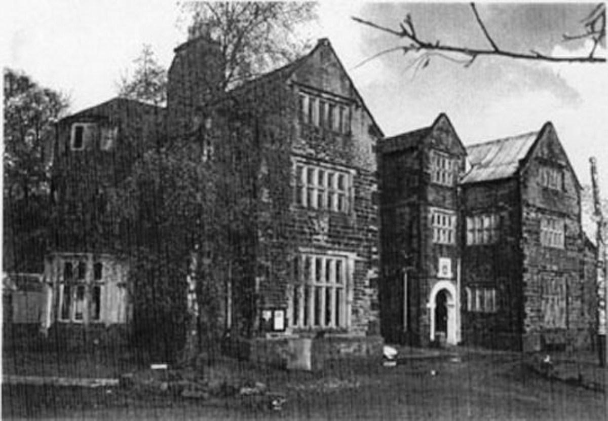
Billinge Hall is probably the home of the ruling family. The Billinge family retained their principal holdings until John Billinge sold the family seat to Francis Bispham in 1691. The Bispham family lived in Bispham Hall.
Travel through Billinge today and you will notice the Merseytravel bus stops change to those of Greater Manchester, the counties of Merseyside and Greater Manchester being created in 1974. Yet this township, which originally included Winstanley, has long been divided into two halves regarded as separate townships, and known as Chapel End and Higher End.
In the Victorian County History circa 1901, “the position of Chapel End township—the eastern one—is bleak and open, and the country bare except in the south, where there are more trees and green fields about the neighbourhood of Carr Mill Dam, a fairly large sheet of water. In the middle of this lake the boundaries of three townships meet. In the north there are sandstone quarries on the highest point of the hill.
There are fields where potatoes, wheat, and oats are grown, besides pastures nearer the base of the hillside. “The village, with its long straggling street and stone houses, spreads from it along the road from Wigan to St Helens, which is the principal thoroughfare.
About the middle of the township it is crossed by another road which runs eastward from the chapel to Ashton in Makerfield. The south-western boundary is formed by Black Brook, near which lies Birchley; and the south-eastern by the Goyt, its affluent, on which is Chadwick Green.
Two detached portions of Winstanley lie on this side. The surface rises from the two streams, a height of nearly 600 ft. being attained at the northern border. Here stands Billinge Beacon.
“At Billinge Higher End the surface falls away somewhat quickly to the south-west boundary, which is formed by Black Brook, and also to the west and north. This ridge of high ground, known as Billinge Hill, is visible for miles around.
There are extensive quarries of sandstone and a gritstone used for making mill-stones. In the north of the district there are one or two unimportant coal-mines. In this part the hill is not entirely bare in spite of its exposed situation, for there are plantations of small pine trees and some larger deciduous trees.
"The west side of the township is occupied by cultivated fields where wheat, oats, and potatoes are grown in a rich sandy soil. On the west lies Billinge Hall; to the north are Bispham Hall, Gautley, and the Great Moss.
On the east a brook divides the township from Winstanley; Longshaw lies here, with the village adjacent, on the road from Billinge chapel to Upholland. The main roads are macadamized; others set with square blocks of native sandstone; they are protected by walls in the upper parts and hedges in the lower parts of the township.”
“A chapel of ease was built here in the time of Henry VIII at the cost of the inhabitants, who also paid the priest's wages.
"At the beginning of Mary's reign James Winstanley of Winstanley, 'minding utterly to destroy the same chapel for ever, out of very malice and hate that he had and bore towards the service of God, which he perceived the Queen's majesty was minded to advance and set forwards,' assembled a band of twenty 'evil-disposed persons,' and forcibly carried off the chalice and paten and other ornaments, broke the windows, turned out forms and chairs and the like furniture, and made it a barn, keeping his hay and corn there by force.”
By 1598 the chapel “was found to be out of repair; there were no books but a Bible, the curate was 'no minister, but one licensed to read.' No attempt had been made to collect the 1s. a week fine for absence from the legal services, nor were there any collections for the poor.
Very few came to the communion thrice yearly; the parishioners could not say the Catechism, and many did not know the Creed, the Lord's Prayer, and commandments.” This old church building was demolished and rebuilt around 1718, and considerably enlarged later. The catholic church of St. Mary was built in 1828.
The hill was used as a beacon at the time of the Spanish Armada, to warn and prepare for invasion by the Spanish. A beacon tower was built as a summerhouse to Winstanley Hall in the 18th century. With no canals, no railways, no trams or trolley buses, or major routes through the village, Billinge remained relatively isolated until the spread of the motor car.
A local board for Billinge was formed in 1872, the district including both the townships and also part of Winstanley. This was succeeded in 1894 by an urban district council of twelve members.
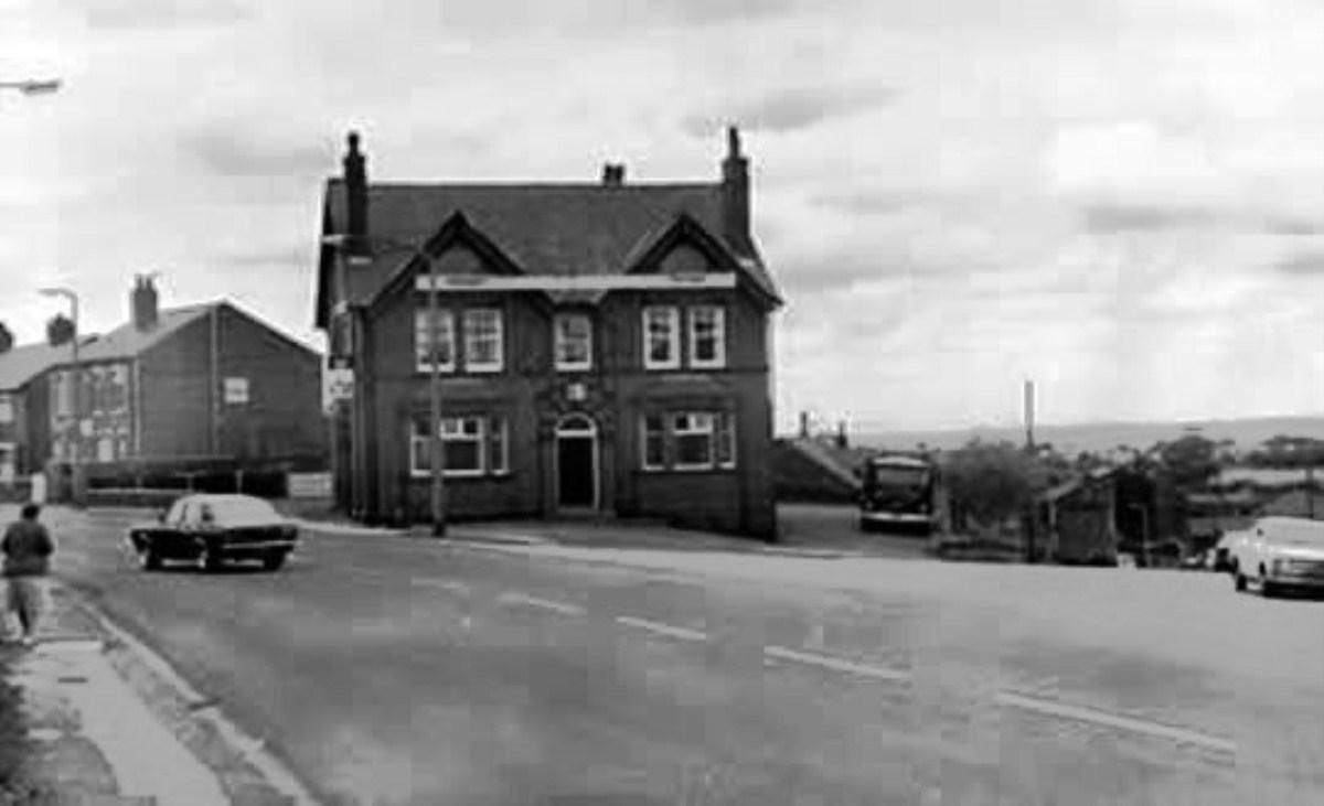
The Stork Inn is probably the most haunted site in the area, with stories of a cavalier who was captured and imprisoned and died there during the Civil War, a local highwayman who lived near the village, and the sounds of horses galloping through the town, but leaving no trace in muddy or grassy areas.


Comments: Our rules
We want our comments to be a lively and valuable part of our community - a place where readers can debate and engage with the most important local issues. The ability to comment on our stories is a privilege, not a right, however, and that privilege may be withdrawn if it is abused or misused.
Please report any comments that break our rules.
Read the rules here